Greater London Monitoring Data
Use the map above to explore the monitoring sites in for this local authority and the surrounding area. The table below shows a summary of sites within this local authority - you can click on the site names to get more detailed information.
Active local authority funded monitoring sites
| Monitoring Site | Ozone (O3) |
Nitrogen Dioxide (NO2) |
Sulphur Dioxide (SO2) |
Particulate Matter (PM2.5) |
Particulate Matter (PM10) |
Highest Pollution Band | Last Updated |
|---|---|---|---|---|---|---|---|
| Barnet Chalgrove School | n/m | n/a | n/m | n/m | n/a | No Data | 02/08/2026 06:00 |
| Barnet Tally Ho | n/m | n/a | n/m | n/a | n/a | No Data | 02/08/2026 06:00 |
| Beech Street NOx | n/m | n/a | n/m | n/m | n/m | No Data | 02/08/2026 06:00 |
| Beech Street PM | n/m | n/m | n/m | n/a | n/a | No Data | 02/08/2026 06:00 |
| Bell Wharf Lane | n/m | n/a | n/m | n/m | n/a | No Data | 02/08/2026 06:00 |
| Brent Ikea | n/a | n/m | n/m | n/a | n/m | No Data | 02/08/2026 05:00 |
| Bromley Harwood Avenue | n/m | n/a | n/m | n/a | n/a | No Data | 02/08/2026 05:00 |
| Camden - Coopers Lane | n/m | n/m | n/m | n/a | n/a | No Data | 29/07/2026 01:00 |
| Camden - Euston Road | n/m | n/a | n/m | n/a | n/a | No Data | 02/08/2026 05:00 |
| Camden High Street | n/m | n/a | n/m | n/m | n/m | No Data | 02/08/2026 06:00 |
| Camden Kilburn | n/a | n/a | n/m | n/a | n/a | No Data | 02/08/2026 06:00 |
| Ealing Acton Background (sensor) | n/m | n/a | n/m | n/a | n/a | No Data | 29/06/2026 24:00 |
| Ealing Elthorne Park High School (sensor) | n/m | n/a | n/m | n/a | n/a | No Data | 29/06/2026 24:00 |
| Ealing Greenford Background (sensor) | n/m | n/a | n/m | n/a | n/a | No Data | 29/06/2026 24:00 |
| Ealing Hanger Lane Gyratory | n/m | n/a | n/m | n/m | 22 (2 Low) | Low (Index 2) |
02/08/2026 07:00 |
| Ealing Havelock Primary School (sensor) | n/m | n/a | n/m | n/a | n/a | No Data | 21/04/2026 17:00 |
| Ealing Horn Lane (LAQN) | n/m | n/a | n/m | n/m | 25 (2 Low) | Low (Index 2) |
02/08/2026 07:00 |
| Ealing John Perryn Primary School (sensor) | n/m | n/a | n/m | n/a | n/a | No Data | 29/06/2026 24:00 |
| Ealing Khalsa Primary School (sensor) | n/m | n/a | n/m | n/a | n/a | No Data | 29/06/2026 24:00 |
| Ealing Lady Margaret Primary School (sensor) | n/m | n/a | n/m | n/a | n/a | No Data | 29/06/2026 24:00 |
| Ealing Northolt High School (sensor) | n/m | n/a | n/m | n/a | n/a | No Data | 01/08/2026 22:00 |
| Ealing Twyford CofE High School (sensor) | n/m | n/a | n/m | n/a | n/a | No Data | 29/06/2026 24:00 |
| Ealing Western Avenue | n/m | n/a | n/m | n/m | 25 (2 Low) | Low (Index 2) |
02/08/2026 07:00 |
| Ealing William Perkin CofE School (sensor) | n/m | n/a | n/m | n/a | n/a | No Data | 29/06/2026 24:00 |
| Fulham Town Centre | n/a | n/a | n/m | n/a | n/a | No Data | 23/06/2026 15:00 |
| Greenwich Westhorne Avenue | n/a | n/m | n/m | n/m | n/m | No Data | 30/07/2026 01:00 |
| Greenwich Woolwich Flyover | n/a | n/m | n/m | n/a | n/m | No Data | 01/08/2026 19:00 |
| Guildhall | n/a | n/m | n/m | n/m | n/m | No Data | 02/08/2026 05:00 |
| Hackney Amhurst Road | n/m | n/a | n/m | n/m | n/a | No Data | 02/08/2026 06:00 |
| Hackney Dalston Lane | n/m | n/a | n/m | n/m | n/a | No Data | 02/08/2026 06:00 |
| Hackney Graham Road | n/m | n/a | n/m | n/a | n/a | No Data | 02/08/2026 06:00 |
| Hackney Green Lanes | n/m | n/a | n/m | n/m | n/m | No Data | 02/08/2026 06:00 |
| Hackney Homerton Library | n/m | n/a | n/m | n/m | n/a | No Data | 02/08/2026 05:00 |
| Hackney Northwold Road | n/m | n/a | n/m | n/a | n/a | No Data | 02/08/2026 06:00 |
| Hackney Old Street | n/a | n/a | n/m | n/a | n/a | No Data | 02/08/2026 06:00 |
| Hammersmith Town Centre | n/a | n/a | n/m | n/a | n/a | No Data | 02/08/2026 05:00 |
| Haringey Wood Green | n/m | n/a | n/m | n/a | n/a | No Data | 02/08/2026 06:00 |
| Heathrow Bath Road | n/m | n/a | n/m | n/a | n/a | No Data | 22/06/2026 10:00 |
| Heathrow Green Gates | n/m | n/a | n/m | 4 (1 Low) | 9 (1 Low) | Low (Index 1) |
02/08/2026 07:00 |
| Heathrow LHR2 | n/m | n/a | n/m | n/a | n/a | No Data | 02/08/2026 06:00 |
| Hillingdon Harmondsworth | n/m | n/a | n/m | n/m | n/a | No Data | 02/08/2026 05:00 |
| Hillingdon Harmondsworth Osiris | n/m | n/m | n/m | n/a | n/a | No Data | 02/08/2026 06:00 |
| Hillingdon Hayes | n/m | n/a | n/m | n/m | n/a | No Data | 02/08/2026 05:00 |
| Hillingdon Oxford Avenue | n/m | n/a | n/m | n/m | n/a | No Data | 02/08/2026 05:00 |
| Hillingdon Sipson | n/m | n/a | n/m | n/m | n/m | No Data | 02/08/2026 06:00 |
| Hillingdon South Ruislip | n/m | n/a | n/m | n/m | 16 (1 Low) | Low (Index 1) |
02/08/2026 07:00 |
| Hounslow Brentford | n/m | n/a | n/m | n/a | n/a | No Data | 31/07/2026 01:00 |
| Hounslow Chiswick | n/m | n/a | n/m | n/a | n/a | No Data | 02/08/2026 05:00 |
| Hounslow Feltham | n/m | n/a | n/m | n/a | n/a | No Data | 02/08/2026 05:00 |
| Hounslow Gunnersbury | n/m | n/a | n/m | n/a | n/a | No Data | 09/06/2026 09:00 |
| Hounslow Hatton Cross | n/m | n/a | n/m | n/a | n/a | No Data | 02/08/2026 06:00 |
| Hounslow Heston | n/m | n/a | n/m | n/a | n/a | No Data | 02/08/2026 06:00 |
| Islington Arsenal Ecology Centre | n/m | n/a | n/m | n/a | n/a | No Data | 02/08/2026 05:00 |
| Islington Holloway Road | n/m | n/a | n/m | n/a | n/a | No Data | 02/08/2026 05:00 |
| Kingston Upon Thames Cromwell Road | n/m | n/a | n/m | n/m | n/a | No Data | 02/08/2026 05:00 |
| Kingston Upon Thames Kingston Vale | n/m | n/a | n/m | n/m | n/a | No Data | 02/08/2026 05:00 |
| Kingston Upon Thames Tolworth Broadway | n/m | n/a | n/m | n/a | n/m | No Data | 02/08/2026 05:00 |
| London City Airport KGV House | n/m | n/a | n/m | n/a | n/a | No Data | 02/08/2026 06:00 |
| London City Airport Newham Dockside | n/m | n/a | n/m | n/m | n/m | No Data | 02/08/2026 05:00 |
| Newham Cam Road | n/m | n/a | n/m | n/a | n/a | No Data | 02/08/2026 05:00 |
| Newham East Ham Town Hall | n/m | n/a | n/m | n/a | n/m | No Data | 02/08/2026 06:00 |
| Newham Wren Close | n/m | n/a | n/m | n/a | n/a | No Data | 02/08/2026 05:00 |
| RBKC Chelsea Old Town Hall | n/m | n/a | n/m | n/m | n/m | No Data | 02/08/2026 06:00 |
| RBKC Cromwell Road | n/a | n/a | n/m | n/a | n/a | No Data | 02/08/2026 06:00 |
| RBKC Earl's Court Road | n/m | n/a | n/m | n/m | n/a | No Data | 02/08/2026 05:00 |
| RBKC Knightsbridge | n/m | n/a | n/m | n/m | n/m | No Data | 02/08/2026 06:00 |
| Redbridge Gardner Close | n/m | n/a | n/m | n/m | n/a | No Data | 02/08/2026 05:00 |
| Redbridge Ley Street | n/a | n/a | n/m | n/a | n/a | No Data | 02/08/2026 05:00 |
| Riverwalk - Frank Banfield Park | n/a | n/a | n/m | n/a | n/a | No Data | 02/08/2026 06:00 |
| Sands End - Carnwath Road | n/a | n/a | n/m | n/a | n/a | No Data | 02/08/2026 06:00 |
| Shepherds Bush Town Centre | n/m | n/a | n/m | n/a | n/a | No Data | 02/08/2026 05:00 |
| Southwark A2 Old Kent Road (FIDAS) | n/m | n/m | n/m | n/a | n/a | No Data | 02/08/2026 06:00 |
| Southwark Elephant and Castle | n/a | n/a | n/m | n/a | n/a | No Data | 02/08/2026 06:00 |
| Southwark Lower Road | n/m | n/a | n/m | n/a | n/a | No Data | 02/08/2026 06:00 |
| Southwark South Circular Road | n/m | n/a | n/m | n/a | n/a | No Data | 02/08/2026 05:00 |
| Southwark Tower Bridge Road | n/m | n/a | n/m | n/a | n/a | No Data | 02/08/2026 06:00 |
| Southwark Vicarage Grove | n/m | n/a | n/m | n/a | n/a | No Data | 02/08/2026 06:00 |
| Sutton Beddington Lane north | n/m | n/a | n/m | n/a | n/a | No Data | 02/08/2026 06:00 |
| Sutton Beddington Village 2 | n/m | n/a | n/m | n/m | n/a | No Data | 02/08/2026 06:00 |
| Sutton Wallington | n/m | n/a | n/m | n/m | n/a | No Data | 21/06/2024 17:00 |
| Sutton Worcester Park | n/m | n/a | n/m | n/m | n/a | No Data | 02/08/2026 06:00 |
| The Aldgate School | n/m | n/a | n/m | n/a | n/a | No Data | 02/08/2026 06:00 |
| Tower Hamlets - Blackwall | n/a | n/a | n/m | n/a | n/a | No Data | 01/08/2026 17:00 |
| Waltham Forest Crooked Billet | n/m | n/a | n/m | n/m | n/a | No Data | 23/06/2026 10:00 |
| Waltham Forest Dawlish Rd | n/m | n/a | n/m | n/a | n/a | No Data | 02/08/2026 06:00 |
| Waltham Forest Leyton | n/m | n/a | n/m | n/m | n/a | No Data | 09/07/2026 09:00 |
| Westminster - Covent Garden | n/m | n/a | n/m | n/a | n/m | No Data | 02/08/2026 05:00 |
| Westminster - Elizabeth Bridge | n/m | n/a | n/m | n/a | n/m | No Data | 02/08/2026 05:00 |
| Westminster - Oxford Street | n/m | n/a | n/m | n/a | n/m | No Data | 02/08/2026 05:00 |
| Westminster - Queens Park Gardens | n/a | n/a | n/m | n/a | n/m | No Data | 02/08/2026 05:00 |
| Wormwood Scrubs - Du Cane Road | n/a | n/a | n/m | n/a | n/a | No Data | 02/08/2026 06:00 |
| Camden Kerbside (Swiss Cottage) | n/m | 14 (1 Low) | n/m | 11 (1 Low) | 23 (2 Low) | Low (Index 2) |
03/08/2026 06:00 |
| Ealing Horn Lane | n/m | n/m | n/m | n/m | 20 (2 Low) | Low (Index 2) |
03/08/2026 06:00 |
| Haringey Roadside | n/m | 30 (1 Low) | n/m | n/m | n/m | Low (Index 1) |
03/08/2026 06:00 |
| London A406 N Circular | n/m | n/m | n/m | 6 (1 Low) | n/m | Low (Index 1) |
03/08/2026 06:00 |
| London Bexley | n/m | n/a | n/m | n/a | n/a | No Data | 31/07/2026 18:00 |
| London Bloomsbury | 70 (3 Low) | 18 (1 Low) | 1 (1 Low) | 6 (1 Low) | 15 (1 Low) | Low (Index 3) |
03/08/2026 06:00 |
| London Farringdon Street | n/m | 16 (1 Low) | n/m | 7 (1 Low) | n/m | Low (Index 1) |
03/08/2026 06:00 |
| London Haringey Priory Park South | 77 (3 Low) | 18 (1 Low) | n/m | 5 (1 Low) | 12 (1 Low) | Low (Index 3) |
03/08/2026 06:00 |
| London Harlington | n/a | n/a | n/m | n/a | n/a | No Data | 02/08/2026 07:00 |
| London Hillingdon | 87 (3 Low) | 19 (1 Low) | n/m | 6 (1 Low) | 14 (1 Low) | Low (Index 3) |
03/08/2026 06:00 |
| London Honor Oak Park | 91 (3 Low) | n/m | n/m | 5 (1 Low) | 12 (1 Low) | Low (Index 3) |
03/08/2026 06:00 |
| London Marylebone Road | 93 (3 Low) | 14 (1 Low) | 2 (1 Low) | 9 (1 Low) | 21 (2 Low) | Low (Index 3) |
03/08/2026 06:00 |
| London N. Kensington (RBKC North Kensington) | 93 (3 Low) | 5 (1 Low) | 1 (1 Low) | 5 (1 Low) | 12 (1 Low) | Low (Index 3) |
03/08/2026 06:00 |
| London Norbury Manor School | n/m | n/m | n/m | 6 (1 Low) | 12 (1 Low) | Low (Index 1) |
03/08/2026 06:00 |
| London Teddington Bushy Park | n/m | n/m | n/m | 5 (1 Low) | 11 (1 Low) | Low (Index 1) |
03/08/2026 06:00 |
| London Westminster | 83 (3 Low) | 12 (1 Low) | n/m | n/a | n/m | Low (Index 3) |
03/08/2026 06:00 |
| Southwark A2 Old Kent Road | n/m | 34 (1 Low) | n/m | n/m | 27 (2 Low) | Low (Index 2) |
03/08/2026 06:00 |
» Visit the Defra UK-AIR website for details of Defra funded AURN monitoring sites
Closed local authority funded monitoring sites
The following monitoring sites are no longer active in this local authority, but you can still access information about them by clicking on their names below.
LOW ( Index 3)
| Very High | 10 |
| High | 9 |
| 8 | |
| 7 | |
| Moderate | 6 |
| 5 | |
| 4 | |
| Low | 3 |
| 2 | |
| 1 |
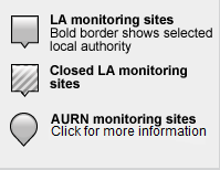
Guide to map markers:
Download uBreathe
The free app for iPhone, iPad & Android that gives you air pollution health advice - where and when you need it most
Find out more »