Buckinghamshire Council Monitoring Data
Use the map above to explore the monitoring sites in for this local authority and the surrounding area. The table below shows a summary of sites within this local authority - you can click on the site names to get more detailed information.
Active local authority funded monitoring sites
Monitoring Site | Ozone (O3) |
Nitrogen Dioxide (NO2) |
Sulphur Dioxide (SO2) |
Particulate Matter (PM2.5) |
Particulate Matter (PM10) |
Highest Pollution Band | Last Updated |
---|---|---|---|---|---|---|---|
Burnham Beeches (sensor) | n/m | 36 (1 Low) | n/m | 5 (1 Low) | 13 (1 Low) | Low (Index 1) |
24/04/2024 20:00 |
Flackwell Heath Juniper Hill School (sensor) | n/m | n/m | n/m | 2 (1 Low) | 5 (1 Low) | Low (Index 1) |
24/04/2024 20:00 |
Iver Heath Infant School (sensor) | n/m | 56 (1 Low) | n/m | 5 (1 Low) | 9 (1 Low) | Low (Index 1) |
24/04/2024 20:00 |
Iver Heath Junior School (sensor) | n/m | 66 (1 Low) | n/m | 4 (1 Low) | 10 (1 Low) | Low (Index 1) |
24/04/2024 20:00 |
Iver Thorney Lane North (sensor) | n/m | 59 (1 Low) | n/m | 4 (1 Low) | 8 (1 Low) | Low (Index 1) |
24/04/2024 20:00 |
Iver Village Junior School (sensor) | n/m | 35 (1 Low) | n/m | 5 (1 Low) | 12 (1 Low) | Low (Index 1) |
24/04/2024 20:00 |
Marlow Holy Trinity School (sensor) | n/m | 24 (1 Low) | n/m | 3 (1 Low) | 5 (1 Low) | Low (Index 1) |
24/04/2024 20:00 |
Princes Risborough School (sensor) | n/m | 41 (1 Low) | n/m | 5 (1 Low) | 10 (1 Low) | Low (Index 1) |
24/04/2024 20:00 |
Stokenchurch Primary School (sensor) | n/m | 5 (1 Low) | n/m | 3 (1 Low) | 4 (1 Low) | Low (Index 1) |
24/04/2024 20:00 |
Wendover Wharf Road (sensor) | n/m | 26 (1 Low) | n/m | 2 (1 Low) | 5 (1 Low) | Low (Index 1) |
24/04/2024 20:00 |
Wycombe Abbey 5 | n/m | 56 (1 Low) | n/m | n/m | n/m | Low (Index 1) |
24/04/2024 19:00 |
Wycombe Millbrook School (sensor) | n/m | 35 (1 Low) | n/m | 4 (1 Low) | 8 (1 Low) | Low (Index 1) |
24/04/2024 20:00 |
» Visit the Defra UK-AIR website for details of Defra funded AURN monitoring sites
Closed local authority funded monitoring sites
The following monitoring sites are no longer active in this local authority, but you can still access information about them by clicking on their names below.
Monitoring Site | Date Ended |
---|---|
Aylesbury Bicester Road [Closed] (AYL9) | 18/03/2010 |
Aylesbury Friarage Road 2 [Closed] (AYL7) | 18/12/2013 |
Aylesbury Stoke Road A413 [Closed] (AYL8) | 14/05/2014 |
Aylesbury Tring Road 2 [Closed] (AYT0) | 31/01/2016 |
Aylesbury Waddesdon [Closed] (AYLW) | 14/02/2013 |
Aylesbury Walton Street 2 [Closed] (AY1) | 20/06/2017 |
Aylesbury Winslow High St Roadside [Closed] (AYL1) | 01/10/2010 |
Chesham [Closed] (CHAM) | 20/04/2010 |
Iver North Park Road (sensor) [Closed] (VS003) | 03/10/2022 |
Iver Village Junior School Roadside (sensor) [Closed] (VS004) | 03/06/2021 |
South Bucks Gerrards Cross [Closed] (GX) | 31/03/2017 |
Wycombe Abbey 4 [Closed] (WYA04) | 24/11/2019 |
Wycombe Hughenden [Closed] (WHU1) | 01/01/2013 |
Wycombe Stokenchurch [Closed] (WSTO) | 12/10/2023 |
LOW ( Index 1)
Very High | 10 |
High | 9 |
8 | |
7 | |
Moderate | 6 |
5 | |
4 | |
Low | 3 |
2 | |
1 |
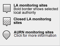
Guide to map markers:
Download uBreathe
The free app for iPhone, iPad & Android that gives you air pollution health advice - where and when you need it most
Find out more »